As so many in this field, I had a keen interest in maps from a young age, which was encouraged by my parents and grandparents. Geography has always been one of my favourite subjects in school (probably tied with History) and I think my 4th grade teacher had a big part in this: he introduced computers to my school — some Commodore 64s with some educational games, including one where you’d have to fly a helicopter around a map. I was hooked on that one, and quite good at it too.
Later on, when I was about 14 years old, I found out you could actually become a cartographer, so my goal was clear. Through chance (and a “take this job and shove it” moment) I ended up starting my own business when I was 27.
My position in the cartographic spectrum is maybe a bit odd — throughout my career I’ve been on both the cartography side and on the GIS side. I make maps and I really enjoy doing that, having been fascinated with them ever since I was a young boy. But as a reseller of a popular software package for data transformation (FME), a large portion of my income is related to that product, and the associated services and training and so on. I love doing that work, but the downside is that it generally doesn’t yield any results that are really good to show to somebody who is not familiar with that industry. A typical result of such a project might be an address database with errors checked and corrected; stuff like that. It’s certainly valuable to my customers but it’s not really something you can show off to people who are not familiar with that subject matter.
Through chance (and a “take this job and shove it” moment) I ended up starting my own business when I was 27.
So I try and do cartography projects whenever I can. They can be either “simple” production projects, or more challenging projects where I can get my data wrangling skills into play. But some of those cartography projects have reached a lot of people, and I think that’s really awesome. I’ve done some very simple maps for a Dutch weather website/app (and several spin-offs for other markets) which are being used by millions of people on a daily basis. In fact, it even got as crazy as that app, with my map, being featured in an ad campaign (print and TV) for a big phone company’s new 4G network. Most recently a Facebook ad for a new Samsung smart watch used that app.

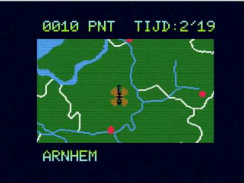
Another project I worked on with several partners, my role being more “under the hood” working with the data rather than the look and feel, is an application that’s used by a TV station to show traffic information during the morning news bulletins.
The feeling I had when I walked in to Stanfords in London and saw an atlas I had contributed to, opened on a 2-page spread filled with maps I had made, is indescribable.
And then there were several globe projects, the “beanbag” globe I worked on for Oolaalaa back in 2006/2007 and various spin-offs of that product (one of them even being featured in National Geographic magazine) being the first one. After that several more of such projects came my way, culminating in the BalancePlanet inflatable globe.


I must admit I get a kick out of seeing my work “in the wild”, especially considering so much of my work, the data wrangling stuff, is more or less invisible. The feeling I had when I walked in to Stanfords in London and saw an atlas I had contributed to, opened on a 2-page spread filled with maps I had made, is indescribable.

It does, in the end, make me feel appreciated and that’s really what it’s all about I think.
But also knowing that millions of people have seen the rain maps fills me with pride. And I guess I thrive on that. I often try to take on projects that have me go outside of my comfort zone a bit so I can learn new things, try out new techniques and technologies. Perhaps the duality of my work is pushing me towards those special projects, almost as if I have something to prove (which is somewhat odd because I don’t necessarily have to be on a pedestal). I don’t do as many production projects as I’d like to, so I try and find the special ones, without saying no to the more mundane projects though — gotta make a living after all. But maybe it’s simply the fact that over time I have built a reputation, at least among my circle of Dutch customers, for being able to handle difficult projects. Once you’ve done a few good things word starts to spread that you can do stuff.
It does, in the end, make me feel appreciated and that’s really what it’s all about I think. I get to do the work that I like, and am pretty good at if I may be so bold, for people who appreciate what I do for them. Oh, and I can make a good living doing that — what more do you want?
Finally I would like to say that I appreciate the international cartographic community and do my best to be an active part of it, sharing the joy and love of maps. Especially considering I work by myself it’s very valuable to have a group of people who you can get inspired by, bounce ideas off or try and help to become better cartographers themselves. We’re not working on our own little islands anymore, but part of the cartography archipelago.
