 Cartographer’s Story #11, by Erin Greb
My daughter often looks at me curiously when I am creating a map, or even looking at a map, assuming that I am working way too much at my job as a cartographer. I explain that I use maps all the time, not just for work, to process the world around me.
Our family recently uprooted ourselves from a small town in Bucks County, PA, to the West Village in NYC, to be closer to my husband’s work. This was a huge change, and I felt like every decision that had to be made required… a map!! So began an enormous spatial analysis project, much different than the usual print maps I make in Adobe Illustrator.
Among many variables were locations of desired schools, neighborhoods that had a good vibe, places that had livable apartments within our budget, proximity to green space, and how easy it would be to either escape the city for a getaway or to have friends and family visit us.
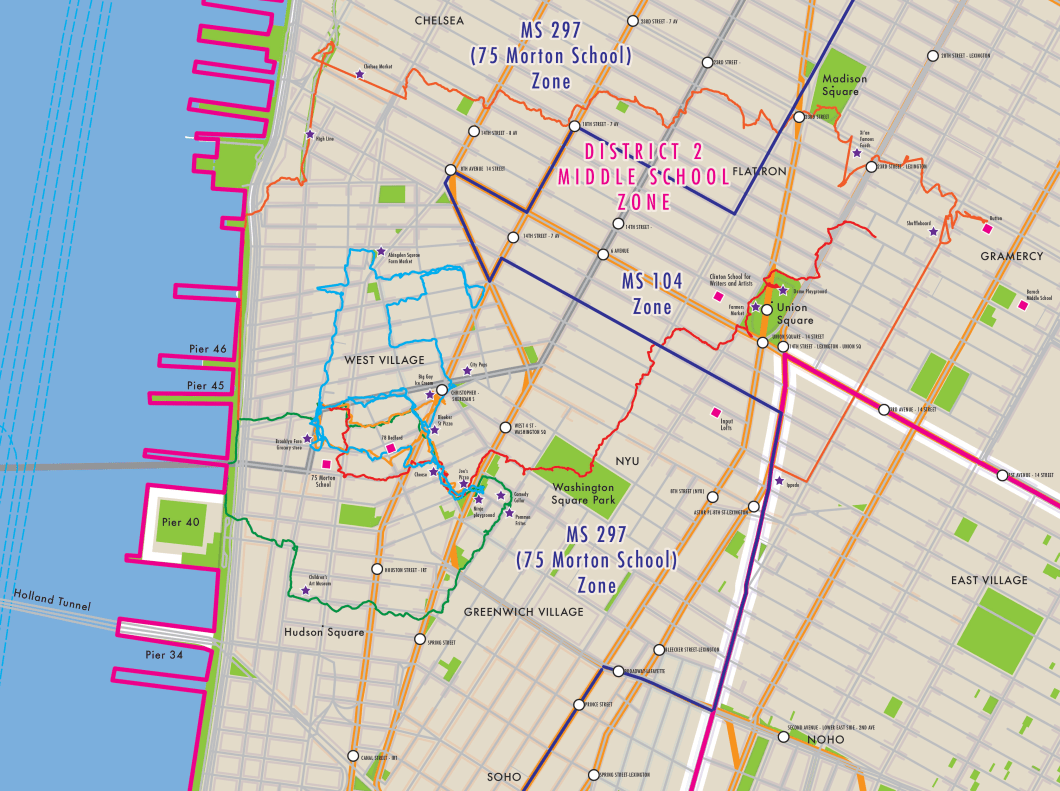
Moving to NYC can be overwhelming, whether you are searching through the never-ending list of middle school possibilities, or enduring the grueling apartment search. Making one giant master map, layering all of the criteria, was necessary for me before ever actually walking around. So once we did spend time in and explore the final cut of neighborhoods, we felt very prepared to make our decisions because of our geographic awareness.
Are we there yet?
When I stop and realize that not everyone handles life decisions in this manner, I wonder how do they even function?
-You mean not everyone has georeferenced the addresses in the school directory to discover which of my neighbors have children at my kid’s school?
– Doesn’t every runner take their GPX tracks from their running app, and add them to OpenStreetMap so that the next time they go out to the woods, the Strava map will show the trails that were missing?
-Am I the only one who, in 2003, drew a giant map of my new town in pencil on a wall using the grid method to transfer from a telephone directory map, marking places where I had eaten and where my friends lived?
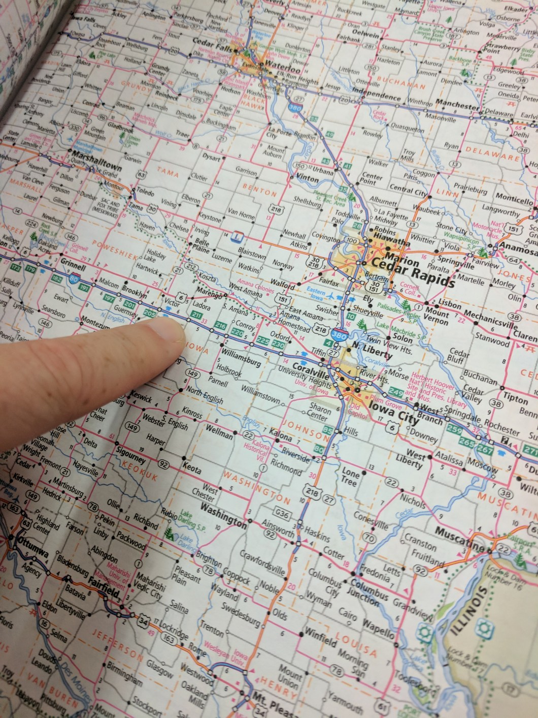
-How many others as children, when sitting in the back of the family station wagon, dragged their finger along the interstate line in the Rand McNally atlas so they didn’t have to ask their parents, “Are we there yet?”
I think in maps… I just can’t get away from it. And I guess that’s why I became a cartographer.
